How to Measure Distance on a Satellite Map
How to Measure Distance on a Satellite Map Quick answer: To measure distance on a satellite map, open a map tool and switch to satellite view. ...
GPS Field Area Measure Editorial
Field GIS Specialist · 11 min read
How to Measure Distance on a Satellite Map
Quick answer: To measure distance on a satellite map, open a map tool and switch to satellite view. Click your start point, then click each turn along the way. The tool adds up the length and shows it in miles, kilometres or feet. Zoom in close for the best result.
Want to know how far it is from your gate to the road? Or how long a fence, a pipe or a cable would need to be? You can measure distance on a satellite map in a few minutes, with no walking and no tape. This guide shows you how, in simple steps. You will also learn how to check your answer and how to avoid the mistakes that give wrong numbers.
What does "measuring distance on a map" mean?
Measuring distance on a map means finding how far one place is from another. You mark points on the map, and the tool works out the length between them. There are two kinds:
- Straight-line distance: the shortest line between two points. People often say "as the crow flies."
- Path distance: the length of a route with turns, like a fence line, a trail or a boundary. Some tools call this continuous distance, because you keep adding points to one long line.
Straight lines are good for quick checks, like the gap between two buildings. Path distance is better for real jobs, because most things you build or walk are not perfectly straight.
Now you know the two kinds of distance. Next, let's see why a satellite view gives better answers than a flat street map.
Why a satellite map gives better answers
A street map shows drawings of roads. A satellite map shows real photos of the ground. That helps in three ways:
- You can see the real edge of a field, a fence, a path or a building.
- You can place points on the exact spot instead of guessing.
- You can measure places that are not on any road, like farmland, forests and open land.
One small warning: satellite photos are not always new. A road or building made last month may not show yet. Use the photo as your guide, and check on the ground for big jobs.
With that in mind, let's measure something. Here are the steps.
How to measure distance on a satellite map in 5 easy steps
- Open the tool. Go to our Distance Ruler. You do not need to sign up.
- Switch to satellite view. Pick the satellite layer so you see real land, not drawings.
- Zoom in on your start point. Zoom until you can see the exact spot, like a gate or a corner. Closer zoom means a better answer.
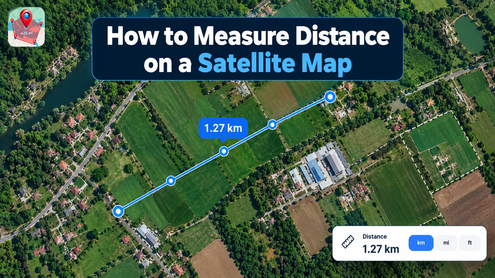
- Click your start and end points. Click where you begin, then click where you finish. The tool draws a line between them.
- Read the number and pick your unit. The total shows on screen. Change it to miles, kilometres or feet if you need to.
Tip: Save your measurement so you can open it again later.
Example: Say you measure the edge of a field. The first side is 850 metres and the second side is 420 metres. The total is 1,270 metres. That is 1.27 kilometres, or about 0.79 miles.
Check your answer: Measure something you already know first. A stretch of road between two kilometre markers is a good test, because the distance is printed on the stones. If the tool shows 1 kilometre, you are clicking accurately, and you can trust your other numbers.
A single line is easy, but real paths bend. So let's look at how to measure a path with many turns.
How to measure a path with many turns
Most real routes are not straight. A fence goes around a corner, and a trail winds through trees. For these, use path distance:
- Click your start point.
- Click at every turn or bend, one after another.
- Add extra clicks on curves. More points make the line follow the curve better.
- If a click lands in the wrong place, fix it before you move on.
- Click your last point. The tool shows the total length.
A note on very long routes: The Earth is round, not flat. A flat-map ruler gets less accurate as the distance grows, because a straight line on a flat map is not the shortest path on a round Earth. That is why flight paths look curved on flat maps. A good tool measures along the curve of the Earth, so long distances stay correct. For jobs the size of a field or a farm, the difference is tiny and you can ignore it.
You may already use Google Maps for this. Let's see how it compares.
Can you measure distance on Google Maps?
Yes. Google Maps has a built-in tool for it, and it is fine for a quick check. Google's menus change from time to time, but the steps are usually these.
On a computer:
- Open Google Maps and find your start point.
- Right-click the spot and choose Measure distance.
- Click to add more points. The total shows at the bottom.
- Drag a point to move it, or click a point to remove it.
On a phone:
- Press and hold on the map to drop a pin.
- Swipe up on the information panel and tap Measure distance.
- Move the map so the circle sits on your next point, then add it.
Google's tool draws straight lines between the points you pick, so it will not follow roads on its own. It will also not work in Google's "Lite mode".
When to use our tool instead: Google Maps is good for a quick number. Our tool is better when you want to keep your work. You can save your measurements, measure area and mark points in the same place, and export your lines as KML or GeoJSON files.
Whichever tool you use, remember it measures what you draw, not what you drive. Here is why that matters.
Measured distance vs driving distance
A measuring tool gives you the length of the line you draw. It does not know about roads, one-way streets, gates or rivers. If you draw a straight line across a lake, it will happily measure it.
That is perfect for fences, pipes, boundaries and open land. But if you want to know how far a drive or walk will be, use a route planner. It follows real roads and paths, so its number will usually be longer than a straight line.
A simple rule: use a measuring tool to measure land, and a route planner to plan a trip.
Now that you know which tool fits which job, let's cover the mistakes that spoil results.
Common mistakes and how to avoid them
- Not zooming in. Your clicks land a little off, and the small errors add up. Zoom in for every point.
- Cutting corners on bends. A straight line is always shorter than a curved path. Click at every turn.
- Mixing up units. Miles and kilometres look alike, and a mile is about 1.6 times longer. Check the unit before you copy the number.
- Using a tilted or 3D view. The picture is stretched and hard to click accurately. Use a flat, top-down view.
- Trusting old photos. Roads, fences and buildings may have changed. Check on the ground for big jobs.
- Forgetting hills. A map measures flat ground, so a slope is longer to walk than the map shows. The gap is small. A 10% slope adds about 0.5%, and even a steep 30% slope adds only about 4.4%. For most jobs you can ignore it.
Quick unit guide
- 1 mile = 1.609 kilometres
- 1 kilometre = 0.621 miles
- 1 foot = 0.3048 metres
- 1 nautical mile = 1.852 kilometres (used at sea and in the air)
How accurate is it?
There are three things that decide how right your number is.
Your clicks. When you click on a satellite map, the answer depends on how closely you zoom in and how carefully you click. At close zoom, small clicking errors stay small. This is the biggest factor you control.
The photo. Satellite photos can be old, and objects in them may have moved. Treat the picture as a very good guide, not as a legal record.
Your phone's GPS. If you walk a path with your phone instead of clicking on the map, most phones are accurate to about 5 metres (16 feet) in open sky. They are worse near buildings and trees. For short distances, clicking on a zoomed-in photo is often more exact than walking with a phone.
For legal boundaries or building work, hire a licensed surveyor. A measuring tool is for planning and estimating, not for legal papers.
You now know the steps and the traps. Next, let's put it into practice with a free tool.
Try the free Distance Ruler
Our Distance Ruler lets you measure distance on a satellite map right in your browser. It is free to start and needs no signup. You can:
- Measure a straight line or a path with many turns
- Save your work and come back to it later
- Use it on your phone or your computer
Want to mark a single spot, like a gate or a well? Try the Point Marker. You can also browse all our Area & Measurement tools.
Once you know how far something is, the next question is often "how much land is inside it?" Our guide on how to measure acres of odd-shaped land shows you how.
Frequently asked questions
How do I measure distance on a satellite map?
Open a map tool and switch to satellite view. Zoom in on your start point and click it. Click each turn along your route, then click your end point. The tool adds up the length and shows it in miles, kilometres or feet.
Is it accurate to measure distance on a satellite map?
It is accurate enough for most everyday jobs when you zoom in and click carefully. The main errors come from clicking off the mark or using old photos. For legal boundaries or building work, hire a licensed surveyor.
What is the difference between straight-line distance and path distance?
Straight-line distance is the shortest line between two points. Path distance follows a route with turns, like a road or fence. Path distance is usually longer and is closer to what you really travel.
Can I measure distance on a map for free?
Yes. Our Distance Ruler is free to start and needs no signup. Open it in your browser, switch to satellite view, and click your points.
Can I measure distance on a satellite map from my phone?
Yes. You can use the tool in your phone's browser, or use our mobile app. Zoom in close so your taps land on the exact spot.
Can I measure distance on Google Maps satellite view?
Yes. On a computer, right-click your start point and choose Measure distance, then click to add more points. On a phone, press and hold to drop a pin, swipe up and tap Measure distance. Google's tool draws straight lines and does not follow roads.
Conclusion
To measure distance on a satellite map, zoom in, click your points and read the total. Click at every bend, check your unit, and test your clicks on a distance you already know. Remember that a measuring tool gives you the length of what you draw, so use a route planner when you want a driving or walking trip. Open the Distance Ruler and try it on your own land today.
Read next: How to Read GPS Coordinates explains the numbers behind every point on a map.
Tags