Draw a Radius Around a Point: Fast, Accurate
Need a radius around a point? See step-by-step instructions, pro tips, and real examples. Draw distance circles on a map in minutes using GpsField.
GpsField
Field GIS Specialist · 8 min read
Draw a Radius Around a Point: Fast, Accurate
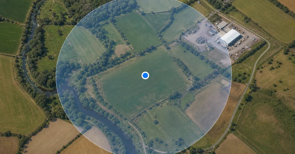
Need to draw a radius around a point fast? Open GpsField’s Area and measurement tools, choose the Radius / pivot circle tool, place your center on the satellite map (or paste coordinates), enter the distance, and you’ll get a clean circle you can save or export. The same workflow handles farm buffers, survey offsets, site standoff zones, service coverage, and more—without wrestling with complex GIS.
What a “radius around a point” map shows (and when to use it)
A radius map is a straight‑line circle centered on a coordinate, address, or clicked map point. It answers “what lies within X metres/feet/miles/kilometres of here?”
Typical professional uses:
- Agriculture: spray buffer compliance, watercourse exclusion zones, irrigation pivot reach.
- Surveying/engineering: control point search rings, crane swing zones, safety standoffs.
- Real estate: amenity proximity (e.g., 0.5 mi to a park or transit).
- Logistics/service: depot coverage checks, same‑day delivery radius, crew dispatch reach.
Note: this is straight‑line (as‑the‑crow‑flies) distance, not a drive‑time analysis.
Step-by-step: drawing a radius on a map in GpsField
Follow these steps for drawing a radius on a map step by step using GpsField.
-
Open the Area and measurement tools
Go to the Area and measurement tools (acreage, perimeter, radius) page: https://gpsfield.com/tools?category=area -
Select “Radius / pivot circle”
Choose the Radius / pivot circle tool to draw a distance circle on the map. -
Set the center
- Click the satellite map at your intended center (e.g., field edge, monument location, tank position), or
- Paste coordinates. Decimal latitude/longitude and common formats are supported; if you need to convert values (UTM, MGRS, DMS), use GpsField’s GPS and coordinate tools here: https://gpsfield.com/tools?category=gps
-
Enter the radius distance and units
Type the required radius (for example, 100 m, 250 ft, 1 mi, or 5 km). The tool draws the circle immediately so you can see what’s included. -
Adjust and verify visually
Drag to fine‑tune the center if needed. Pan/zoom the satellite map to verify field boundaries, roads, buildings, or water features relative to the circle. -
Add more circles (optional)
For tiered coverage or buffer zones, repeat with additional distances. You can draw multiple radius circles on one map for quick comparisons. -
Save, label, and export
Name your circles clearly (e.g., “Spray buffer 100 m”). Keep related work organized in project folders using the main map workspace. Export to GIS formats when you need to share or continue work elsewhere.
Switching units quickly (hectares/acres, metres/feet)
Enter the radius in the units your spec requires—metres/feet for site safety and agronomy, miles/kilometres for depot reach. For area references, remember:
- 1 hectare (ha) = 10,000 m² = 2.471 acres
- 1 square mile = 640 acres These help you communicate results in both metric and imperial without re‑drawing.
Saving and organizing circles in project folders
Use the main workspace to save measurements and group related items (by farm, jobsite, client, or date). Saved measurements and project folders help you revisit and update buffers or standoff zones as specs change. For marking precise centers or nearby features, add a Point marker / points of interest alongside your circles.
Export options: KML, GeoJSON, Shapefile, DXF
When you need to deliver a radius map to colleagues or import it elsewhere:
- Export supported formats: KML, GeoJSON, Shapefile, and DXF.
- If you need to convert between GIS formats for other systems, use GpsField’s GIS file converters (KML, GeoJSON, Shapefile, GPX, DXF).
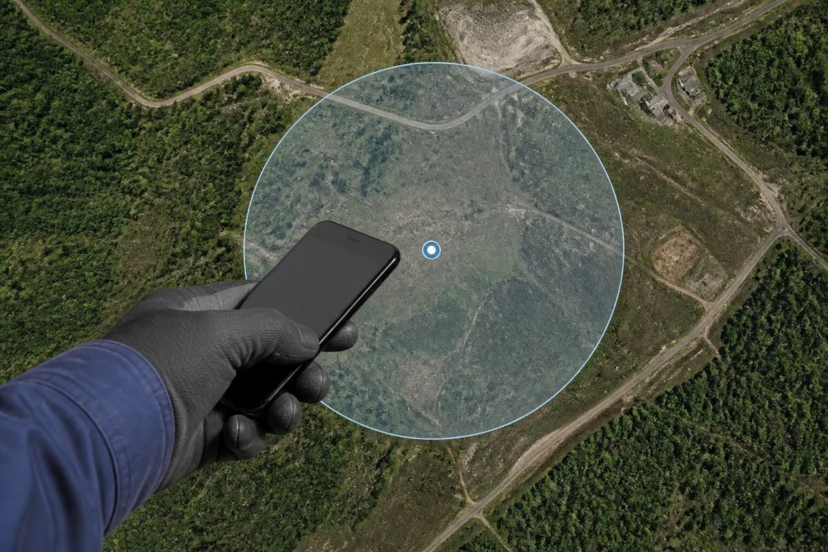 Placing the center point before drawing a distance circle on a map
Worked examples from the field
Below are three quick, unit‑checked examples you can match to your own jobs.
Agronomy buffer: 100 m radius around a watercourse
- Radius r = 100 m = 0.1 km
- Area formula: A = πr²
- A = 3.1416 × (0.1 km)² = 3.1416 × 0.01 = 0.031416 km²
- Convert to hectares: 0.031416 km² × 100 = 3.1416 ha
- Convert to acres: 3.1416 ha × 2.471 = ≈ 7.76 acres
Use this area to estimate the acreage affected by a buffer requirement.
Survey control: 250 ft offset search ring for a missing monument
- Radius r = 250 ft = 76.2 m
- A = πr² = 3.1416 × (76.2 m)² = 3.1416 × 5806.44 ≈ 18,241.5 m²
- Convert to hectares: 18,241.5 m² ÷ 10,000 ≈ 1.824 ha
- Convert to acres: 18,241.5 m² ÷ 4046.856 ≈ 4.51 acres
Set this ring to guide your field search and metal detection pattern.
Logistics coverage: 1 mile radius around a depot
- Radius r = 1 mi
- A = π × 1² = 3.1416 square miles
- Convert to acres: 3.1416 × 640 ≈ 2010 acres
This straight‑line circle gives a quick view of potential same‑day bike or foot deliveries. For vehicles, remember this is not a drive‑time analysis.
Drawing multiple radius circles on one map
- Use concentric rings (e.g., 5 km, 10 km, 20 km) to show service levels or response times by tier.
- Color‑code or label each ring (e.g., “Priority 5 km,” “Economy 20 km”) so crews can act quickly in the field.
- Export all circles together to KML/GeoJSON for sharing by email or for import to other GIS and design platforms.
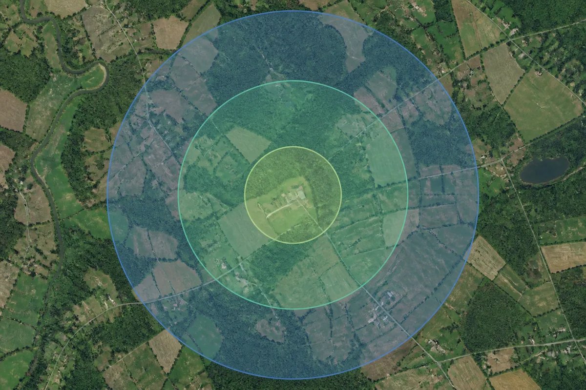 Multiple radius circles on one map for coverage tiers
Can you draw a radius on Google Maps?
Google Maps does not include a built‑in radius tool. Manual workarounds are slow and fiddly. If you need an alternative to drawing a radius on Google Maps, use GpsField to create the circle in seconds, then export your radius to KML to view in Google Earth or import into other platforms.
Accuracy notes: straight‑line vs drive‑time, and how GpsField calculates
- A distance circle map is straight‑line distance. Drive‑time maps use road data and routing; they answer a different question and will not match a simple radius.
- GpsField area and distance are computed geodesically on the WGS‑84 ellipsoid, which accounts for the Earth’s curvature on larger sites.
- Overall accuracy depends on center placement quality: GPS reception, satellite image alignment, and careful clicking all matter.
- For legal boundaries, property disputes, land registration, or construction setting‑out, always use a licensed land surveyor.
Pro tips for reliable radius circles in the field
- Pin the exact center with known coordinates (control point, surveyed asset). If you need to translate formats, see the GPS and coordinate tools (UTM, MGRS, DMS).
- If you must use a phone GPS in dense canopy or near buildings, step into clearer sky to lock the center more reliably before placing it on the map.
- Choose units that match the spec sheet: metres for agronomy buffers, feet for site safety plans, miles/kilometres for depot coverage.
- Use consistent names: “Tank standoff 100 m,” “Crane swing 75 ft,” “Depot Tier 1 – 5 km.”
- Export and share with crews; keep a dated copy for compliance or safety records.
Try it now: draw your radius around a point
- Open the Area and measurement tools (acreage, perimeter, radius): https://gpsfield.com/tools?category=area
- Pick Radius / pivot circle and drop your center point (or paste coordinates).
- Enter the distance in miles or kilometers (or feet/metres), then export if needed.
Frequently asked questions
How do I measure a radius in miles vs. kilometers?
Enter the distance using your preferred unit when you create the circle. If you need to communicate in both systems, remember 1 mile ≈ 1.609 km. For area references: 1 square mile = 640 acres, and 1 hectare = 2.471 acres.
Can I draw multiple radius circles on the same map and save them?
Yes. Create concentric rings or different centers as needed, then save your work and organize it in project folders in the main map workspace. This is ideal for tiered service areas, safety zones, or comparing buffer sizes across several fields or jobsites.
Can I export my radius circle as KML, GeoJSON, Shapefile or DXF?
Yes. Export the circle(s) to KML, GeoJSON, Shapefile, or DXF to share with colleagues or import into other GIS/CAD platforms. If you later need to convert between formats, use GpsField’s GIS file converters (KML, GeoJSON, Shapefile, GPX, DXF).
How accurate is a distance circle map compared to a drive‑time map?
They answer different questions. A radius map is straight‑line distance; it’s excellent for buffers, offsets, and standoffs. Drive‑time maps incorporate road speed and connectivity, so their shapes differ. In GpsField, calculations are geodesic on WGS‑84, but the reliability of your result still depends on how precisely you place the center point.
Ready to put this to work? Open GpsField’s Area and measurement tools and draw your radius around a point in minutes: https://gpsfield.com/tools?category=area
Tags & Topics